Tracing the Footsteps of Ice: A Practical Field Method for Identifying Glacial Erratics
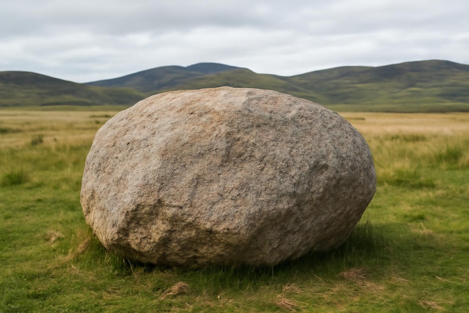
Glacial erratics—isolated rocks or boulders that differ from the local bedrock—have fascinated observers for centuries. In the 19th century they were key evidence in the debate over ice ages and the mechanisms that shaped landscapes. Today, mapping and describing erratics remains a valuable, low‑tech way to reconstruct former ice flow directions, source regions, and human interactions with glaciated terrain. The method below is non‑destructive, suitable for citizen scientists and field naturalists, and grounded in the same observational logic that early glacial pioneers used.
Step-by-step method
Follow these steps to identify, document, and make preliminary inferences about a suspected glacial erratic.
-
Initial survey and context.
Note the boulder’s position in the landscape: isolated on a plain, perched on till, sitting in a moraine, or within a river terrace. Record GPS coordinates, elevation, and proximity to obvious outcrops or bedrock exposures.
-
Photographic record.
Take photos from multiple angles: a scale shot (include a person or measuring rod), a close-up of surface texture, and an image showing the boulder within its surroundings. Photograph any surface features such as striations, polish, or lichens.
-
Basic dimensions and orientation.
Measure approximate length, width, and height. Note the longest axis orientation with a compass; many glacially transported boulders align with the direction of ice movement or rolling during transport.
-
Rock type and hand‑lens inspection.
Using a hand lens (10x–20x), examine mineral grains and texture. Is the rock igneous, metamorphic, or sedimentary? Common erratics include granite, gneiss, quartzite, and exotic volcanic rocks. Record color, grain size, foliation, and any distinctive minerals.
-
Surface features and evidence of transport.
Look for glacial polish (a shiny surface), linear grooves or striations, faceting, or percussion marks from collisions. Rounded shapes and perched positions on finer sediments also support a glacial origin.
-
Compare to nearby lithology.
Check local bedrock exposures. If the boulder’s lithology is unlike local rocks, it strengthens the interpretation as an erratic. Note potential source directions by identifying bedrock outcrops that match the boulder’s composition in the surrounding landscape or along inferred ice flow lines.
-
Record human context.
Note signs of human movement or placement: tool scars, mortar, inscriptions, or location in a constructed feature. Many large stones have been transported by people for monuments, walls, or foundations and are not true erratics.
-
Synthesis and preliminary inference.
Combine orientation, lithology, and position to suggest likely transport direction and possible source area. Map multiple erratics in an area to infer former ice flow paths and deposition centers.
Variations
-
Coastal and cliff settings.
Erratics on beaches may have been reworked by waves. Document tide state and sediment dynamics; focus on immobile large boulders or those on raised beaches to avoid modern reworking confusion.
-
Urban and agricultural landscapes.
In populated areas, many large stones have been moved. Favor stones in undisturbed contexts (hedgerows, field centers) and look for weathering patterns consistent with long exposure rather than recent placement.
-
Remote sensing and mapping variation.
Where many erratics exist, a pattern analysis using simple transects or grid sampling improves reconstruction. Note clusters, linear alignments, and associations with moraines or drumlins.
-
Educational variation for schools.
Simplify identification to color, hardness (scratch test on glass), and rough grain size for classroom groups, with careful instruction on avoiding sampling or defacement.
Troubleshooting
-
Ambiguous lithology.
If you can’t identify the rock type in the field, photograph multiple close-ups and consult a field guide or community geology group. Non‑destructive thin‑sectioning and lab tests aren’t necessary for most reconstructions.
-
Confused with river cobbles or talus.
River transport rounds and sorts clasts differently: look for a matrix of similar material, imbrication, or stream terraces. Talus from nearby cliffs typically has angular fragments matching the cliff source.
-
Weathering masks features.
Heavy lichen or weathering crusts can hide polish and striations. Gently clearing small patches (where permitted) with a soft brush or photographing a natural break can reveal underlying textures without damaging the specimen.
-
Access and conservation constraints.
Respect protected sites and private property. When access is limited, focus on public exposures, or use binoculars and distant photography to gather useful observations without entry.
Erratics connect present landscapes to distant source regions and the dynamics of former ice. With careful observation, simple measurements, and a bit of historical perspective on how such stones informed early geology, you can add meaningful data to local records and deepen your understanding of Earth’s icy past.