Studio Notes: Why Catatumbo Lightning Keeps Flashing—A Field Notebook
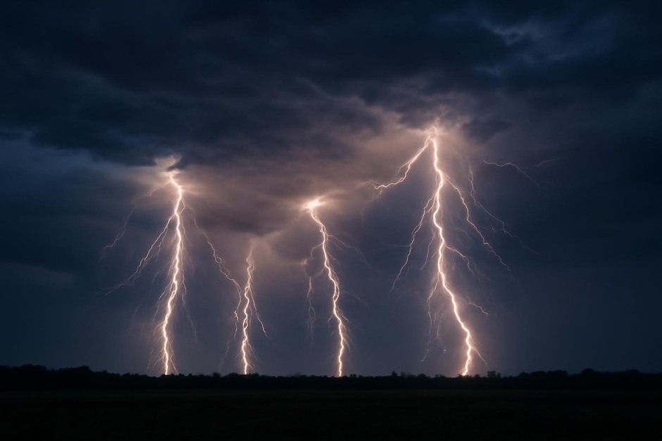
Opening observation: Some nights a single patch of the sky on the shores of a South American lake seems to flash without pause. The spectacle known locally as Catatumbo lightning has been described for centuries, but the studio question I bring to these notes is focused and pragmatic: what combination of local conditions sustains such frequent, repeated lightning over the same area?
The question: defining persistence and scale
In the field I start by sharpening the question. “Persistence” can mean nightly activity, seasonal peaks, or a statistical excess of discharges per hour relative to nearby regions. I frame the core question as three nested queries:
- What temporal patterns characterize the flashes—continuous through the night, spikes near dawn, or episodic clusters?
- What spatial footprint does the activity occupy—tied to a single bay, a river mouth, or a wider basin?
- Which meteorological variables (wind, temperature, humidity, instability) consistently correlate with high discharge rates?
Framing the question this way determines what instruments and observations will be necessary and helps separate local drivers from coincidental weather patterns.
Process: observation strategy and instrumentation
Field work balances continuous remote sensing with on-the-ground sampling. A practical observation plan pairs three threads:
- Remote detection: High-speed optical sensors and very low frequency (VLF) radio receivers provide continuous records of discharge timing and energy without intrusive presence.
- Meteorological profiling: Radiosondes or repeated balloon launches capture vertical temperature, humidity, and wind shear. Surface towers log boundary-layer changes and heat fluxes tied to the lake and surrounding wetlands.
- Local sampling: Portable gas analyzers and aerosol counters assess concentrations of methane, volatile organics, and particulates that can modify breakdown thresholds or provide ionization pathways.
In practice, logistical constraints—access, power, and weather—mean sampling is often intermittent. That makes robust, continuous remote records crucial for identifying patterns that short campaigns can then probe in detail.
Interpretation: assembling a working hypothesis
With data streams aligned, several mechanisms combine into a multilayered interpretation rather than a single cause:
- Topographic confinement: The funneling of low-level winds by valleys and the lake basin concentrates moisture and convergent flow in a predictable area. Convergence zones help initiate and sustain convective cells repeatedly over the same footprint.
- Thermodynamic support: High humidity and warm boundary-layer temperatures maintain shallow instability through the night, especially when nocturnal cooling is suppressed by local circulation or continuous moisture supply from the lake and wetland soils.
- Charged microphysics and aerosols: High aerosol loading or traces of combustible gases like methane, released from sediments and marshes, could alter cloud microphysics or lower the effective breakdown threshold, making discharge initiation easier. Evidence here is suggestive but not definitive.
- Repeated triggering: Small-scale circulations—gust fronts, land-breeze boundaries, or orographic updrafts—can continually re-seed electrified clouds over the same area, so the observed persistence is a product of many short-lived convective events rather than a single, endlessly sustained thunderstorm.
Putting these together: the site acts as a persistent generator of small convective bursts that repeatedly charge and discharge, producing the high flash rate observed. No single factor fully explains the phenomenon; rather, the synchronization of topography, moisture, and microphysical conditions does.
Review: uncertainties, pitfalls, and next steps
Reviewing the field notes highlights several persistent uncertainties and methodological cautions:
- Correlation versus causation: Methane or aerosol enhancements often coincide with lightning hotspots, but proving causality requires controlled experiments or long-term co-variation that isolates these variables.
- Sampling bias: Short campaigns risk confusing a seasonal maximum with a characteristic behavior. Continuous remote records mitigate this but lack some chemical detail.
- Scale mismatch: Processes from centimeters (charge separation on hydrometeors) to kilometers (regional circulation) interact. Integrating models across scales remains a challenge.
Recommended next steps emphasize integrated, multi-year monitoring combining continuous electromagnetic sensing, routine atmospheric profiling, and targeted chemical sampling during predicted high-activity windows. Modeling efforts should focus on coupling mesoscale circulation with explicit microphysical and electrification schemes to test which factors are necessary versus merely facilitative.
Measured conclusion: The Catatumbo’s fame for incessant lightning seems less like a single mystery and more like a choreographed outcome of place-specific drivers: basin-shaped airflow, steady moisture supply, and microphysical conditions that favor frequent charge cycles. The studio approach—pose a precise question, align complementary observations, assemble a working hypothesis, and honestly review gaps—keeps the investigation grounded. The phenomenon resists a simple explanation, but it rewards patient, multidisciplinary scrutiny.